 BGS Data Catalogue
Geophysical surveys
Type of resources
Available actions
Topics
Keywords
Contact for the resource
Provided by
Years
Formats
Representation types
Update frequencies
Service types
Scale
Resolution
-
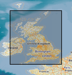
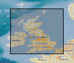
The Geophysical Properties dataset consists of density, velocity, magnetic susceptibility and thermal conductivity values, with related source, location and geology data. The data have been collected on a project basis, therefore the quality and completeness of the database coding is variable. The data is currently from the UK and Ireland although this may be extended. The data consists of samples with related data values - (1,000s), Density Values - Laboratory Measurements - (1,000s); Velocity Values - Laboratory Measurements - (1,000's), Magnetic Susceptibility Values - Laboratory Measurements - (1,000s); Magnetic Susceptibility Values - Field Measurements - (10,000s measurements on 1,000s samples). Borehole information for data obtained as Downhole profiles with related data values; British Rock Densities Project - Insitu density values obtained from the analysis of formation density logs - (10s boreholes with 100s values). Downhole Magnetic Susceptibility - Obtained for a confidential project with some offshore - (10s boreholes with 10,000s samples) . Thermal Conductivity - (100s boreholes with 1,000s samples), Mean Data Values derived from a data source such as published literature for a site or rock formation; Density - (100s), Magnetic Susceptibility - (100s). Information about the source from which data is obtained, Engineering Geology Laboratory Reports - (100s), Literature which may be published or unpublished - (100s). The database is not maintained and no new data has been added since 2004.
-
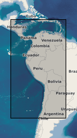
Data from geophysical surveys in many South American and Caribbean countries carried out by the British Geological Survey for different agencies. The surveys range from regional gravity and airborne magnetic mapping to targetted surveys for mineral and water. Individual surveys do not yet have metadata entries: this entry describes a notional database that represents all geophysical surveys carried out within the region.
-
This data set is an archive of original data for the seismic reflection surveys conducted by the National Coal Board (NCB) and its successor, British Coal Corporation (BCC). The data consists of observers' logs, surveyors' reports, (some 3000 files of written records), location data, field data records and processed data. The processed data are at various stages of processing from demultiplexed field data to migrated stack (not all available for all profiles). The data were originally recorded on over 13000 tapes and have been transcribed to more modern media in Tape Image Format (TIF/ARC) to retain the tape block integrity. These data are owned by the Coal Authority (CA), as successor to the NCB and BCC, BGS being the custodian under an agreement with the CA. The Coal authority surveys cover various areas in the UK, shot and processed or reprocessed between 1973-94. There is at an initial estimate half a terabyte of Coal Authority data. The seismic data will be stored as standard format SEGY files which can be read by a variety of software packages designed to manipulate seismic data. Catalogue available.
-

This digital data set contains original files of seismic reflection survey location (navigation) data and dates from the late 1970s. These provide location information for the Digital Seismic Sections data set (DIGSEISECS) and some of the printed seismic sections of the Original Seismic Sections dataset (ORIGSEISECS) and Copy Seismic Sections dataset (COPYSEISECS). Most data are within the UK Onshore area; although there are some UK near-shore and offshore (North Sea, Irish Sea) and foreign data. Most data were acquired for commercial hydrocarbon exploration and subsequently provided to BGS for use on specific projects. Some data were acquired by BGS (British Geological Survey) and other public-sector bodies, e.g. BIRPS (The British Institutions Reflection Profiling Syndicate), for academic research. The data are used with the Seismic Locations and Sections Database (LOCSEC) and for workstation-based interpretation. There are approximately 20 tapes and 15 Exabyte cartridges. The data are mostly concentrated in coal, oil and gas prospecting areas.
-

This document data set contains paper copies of selected geophysical borehole logs made from the master data set held by the BGS National Geological Records Centre (NGRC) at Keyworth. These have been made for interpretation. Most data are within the UK onshore area; although there are some UK near-shore and offshore (North Sea, Irish Sea) and foreign data. Most data were acquired for commercial hydrocarbon exploration and subsequently provided to BGS for use on specific projects. Some data were acquired by BGS and other public-sector bodies for research purposes (e.g. geothermal energy). The documents are dyeline prints or plain-paper photocopies. They are stored folded in boxes, approx 20 logs per box, approx 500 boxes. There are some duplicates. Only a sub-set of the available borehole logs have been copied, usually for deep boreholes or boreholes of special significance in the interpretation of seismic data. Mostly concentrated in areas prospective for coal, oil and gas.
-

The Seismic Locations and Sections database (LOCSEC) stores digitised seismic reflection survey location and line-interpretation data. Supplementary data stored includes map projection information and rock-unit seismic velocity data. The data are grouped by interpretation project area. Location data are input from digitised seismic shotpoint (SP) or common depth point (CDP) maps, or from direct input of digital navigation data. [See: Original Seismic Shotpoint Location Maps (ORIGSPMAPS) and Digital Seismic Shotpoint Location Maps (DIGSPMAPS) datasets]. Line-interpretation data are input from digitised pick-lines on manually interpreted printed seismic sections. [See: Copy Seismic Sections dataset (COPYSEISECS)]. In-house software is used for data management and display, to perform interpretation related tasks, e.g. depth-conversion, and to merge data into X, Y, Z form for input to 3D mapping and modelling packages such as EarthVision. Data in LOCSEC may also be related to the borehole interpretations held in the Stratigraphic Surfaces Database (SSD). Almost all data are within the UK Onshore area; although there are some UK near-shore and offshore (North Sea, Irish Sea) and foreign data. Most data were acquired for commercial hydrocarbon exploration and subsequently provided to BGS for use on specific projects. Some data were acquired by BGS and other public-sector bodies, e.g. BIRPS, for academic research.
-
This database stores down-hole stratigraphic data to complement the seismic surface picks stored in the Seismic Locations And Sections Database (LOCSEC). Because these surfaces are chosen for their visibility on seismic data, they may not be directly equivalent to established BGS lithostratigraphic and/or choronstratigraphic divisions. However, the local coding system is based on and can relate to the BGS stratigraphic LEXICON. Stratigraphic picks are stored in terms of depth and seismic one-way travel time. Local borehole summary information (location, elevation, etc.) is used because both onshore and offshore boreholes are stored in this database. These data can be related to the BGS onshore borehole database by borehole registration, and to the offshore well database by DTI well-id. Additional tables (under development) provide information on hydrocarbon tests and their results. Almost all data are within the UK Onshore area; although there are some UK near-shore and offshore (North Sea, Irish Sea).
-

This document data set contains original prints, on paper, sepia or film, of seismic reflection survey location (navigation) maps. These provide the location data for the seismic sections of the Original Seismic Sections (ORIGSEISECS) and Copy Seismic Sections (COPYSEISECS) datasets. Almost all data are within the UK onshore area; although there are some UK near-shore and offshore (North Sea, Irish Sea) and foreign data. Most data were acquired for commercial hydrocarbon exploration and subsequently provided to BGS for use on specific projects. Some data were acquired by BGS and other public-sector bodies, e.g. BIRPS, for academic research. All maps are digitised upon receipt (see LOCSEC database) and then archived in this data set. (Copies used to be used for interpretation purposes but this is no longer the case.) Documents stored rolled in tubes. Approx 800 maps.
-
This document dataset contains original prints, on paper, sepia or film, of seismic reflection survey sections, dating from the 1960s. Most data are within the UK onshore area; although there are some UK near-shore and offshore (North Sea, Irish Sea) and foreign data. Most data were acquired for commercial hydrocarbon exploration and subsequently provided to BGS for use on specific projects. Some data were acquired by BGS and other public-sector bodies, e.g. BIRPS (British Institutions Reflection Profiling Syndicate), for academic research. This data set is a master set; copies must be used for interpretation purposes. Documents stored rolled in tubes, approximately 10 sections per tube, approx 850 tubes. The data are mostly concentrated in areas prospective for coal, oil and gas.
-
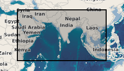
Data from geophysical surveys carried out by the British Geological Survey in many countries in the Middle East, the Indian sub-continent and Indo-China for different agencies. The surveys range from regional gravity and airborne magnetic mapping to targetted surveys for mineral and water. Individual surveys do not yet have metadata entries: this entry describes a notional database that represents all geophysical surveys carried out within the region.